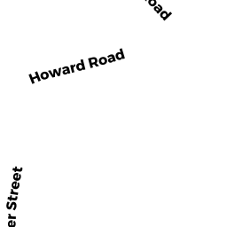
56 THURSTON POINT RD
Owner Information
WARD JAMES III & MESSERMAN LYNDA TRS
16 SAGAMORE RD
IPSWICH, MA 01938


Property Details
56 THURSTON POINT RD is classified as a Single Family Waterfront (Colonial).
The primary structure on this property was built in 1900. There are 3,235ft2 of built area within this property. There is 2,418ft2 of residential/living space within this property.
56 THURSTON POINT RD is valued at $1,618,100. The land is valued at $1,293,400 and the structures are valued at $315,400. There is an additional valuation of $9,300 on this property.
This property is in Zone R-10. Confirm with local Zoning Board authorities to ensure there are no overlays or other easements on this property.
The most recent deed for 56 THURSTON POINT RD is recorded at the local registrar in Book 34085, Page 25. 56 THURSTON POINT RD was last sold on Wednesday, May 27, 2015 for $0.
Assessment data from fiscal year 2022.
Flood Data
This property is partially within the AE Zone (within floodplain). Approximately 0.17 acres (14.55%) of the property is within this zone.
The base flood elevation for this flood zone is 13 feet.
This information is sourced from the FEMA National Flood Hazard Layer. See our full disclamer.
Broadband Internet Providers
| Provider | Type | Bandwidth (mbps) | |
|---|---|---|---|
| VSAT Systems, LLC. | Satellite | 2 | 1 |
| Viasat Inc | Satellite | 100 | 3 |
| Verizon New England Inc. | DSL | 15 | 1 |
| Comcast | Cable | 1000 | 35 |
| GCI Communication Corp. | Satellite | 0 | 0 |
| HughesNet | Satellite | 25 | 3 |
Broadband service provider data from December 2020.
Adjacent Properties
- 9A CEDAR LN
Undevelopable Residential Land owned by O'SHEA TIMOTHY C & CATHERINE A - 1 CEDAR LN
Single Family Residential owned by BRAMHALL LOUISE C - 54 THURSTON POINT RD
Single Family Waterfront owned by BOSAN OF CAPE ANN INC - 13 CEDAR LN
Single Family Waterfront owned by CLIFFORD ARTHUR P & MICHAEL TRS - 11 CEDAR LN
Single Family Residential owned by CARUSO FRANK A & PAULA C TRS - 9 CEDAR LN
Single Family Residential owned by O'SHEA TIMOTHY C & CATHERINE A